Google Maps is immensely helpful in finding navigation routes and estimating the time to reach your destination. It also helps locate places of interest such as malls, cafes, movie theatres, airports, railway stations, etc. The app has numerous small icons that serve different purposes.
If someone is unfamiliar with Google Maps icons, they may have difficulty understanding how to use the app. In this guide, I have explained the different icons and symbols appearing on Google Maps. Knowing these symbols will help you navigate the map better and use it thoroughly.
Google Maps Home Screen Icons
When you launch Google Maps, you land on the app’s home screen. Let us check out the various symbols commonly seen on the home page.
Maps icon
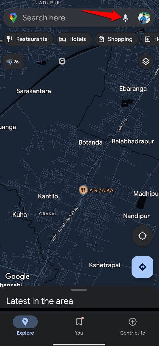
This icon appears on the leftmost side of the Google Maps search bar. Tap it to view the recently visited locations.
![]()
![]()
Microphone Icon
Instead of manually searching for places of interest, press the Microphone icon to issue a voice command and search your desired location.
Quick Find Places of Interest
Right below the search bar, you can see several icons with labels such as Hotels, Restaurants, Coffee, Groceries, Shopping, ATMs, Petrol Pump etc.
You may tap on any of these icons to access the particular place of interest close to your precise location.
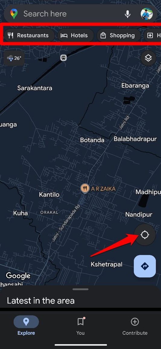
For instance, if you are looking for coffee shops/cafes close to your location, tap on Coffee.
Stacked Square Icon
This icon can be seen on the right side of the Google Maps home screen. Tap on it to change the Map type. There are three types of Map view: Default, Satellite, and Terrain.
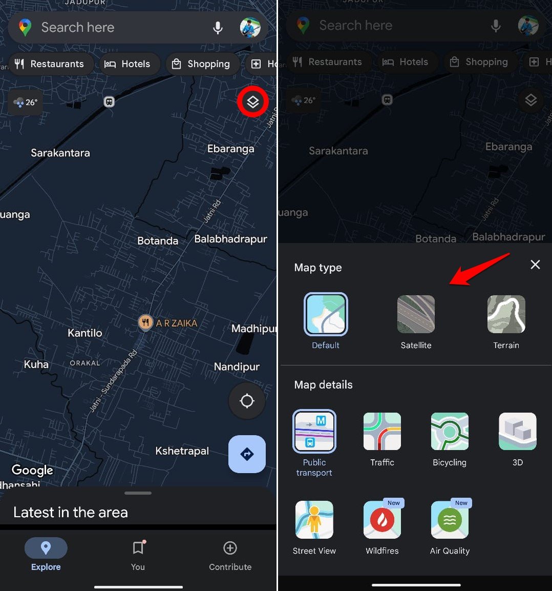
You can also see the public transport facilities near your location, view 3D Maps, get a street view of your location, and learn about wildfires that may have occurred nearby. Also, you can check the air quality and current traffic situation near you.
Direction/Compass Icon
It is a circular icon with four pointers pointing in different directions. Tap this button to view your precise location.
Once you view your precise location, the 4-pointer circle will turn blue. Further tapping the circular icon will turn it into a compass button.
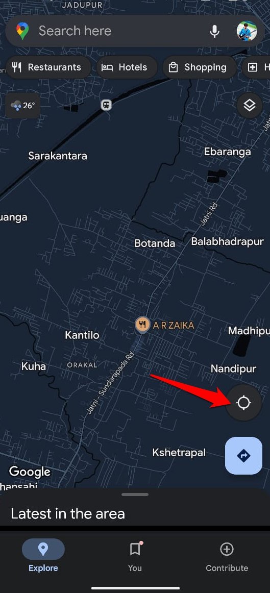
The compass becomes active to determine the direction of your destination when you set a location and start your journey toward it.
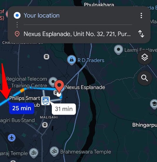
Deflated Right Arrow Inside Blue Square
Press this icon to determine the direction between two points when you travel by foot, car, bike, or bus. Normally, your current location will be marked as the starting point.
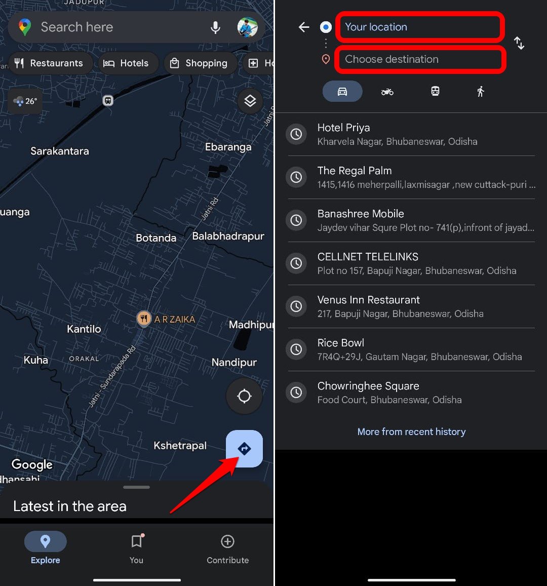
Icons on the Journey Estimate Screen
When you set starting and ending points for a journey, there are several symbols to watch out for on the Gmaps screen.
Arrows Pointing in Opposite Direction
Press this button to swap the source and destination points on the map.
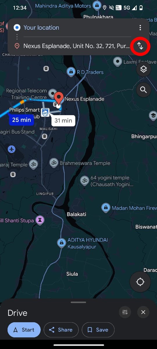
Car/Bike/Bus/Walk Icons
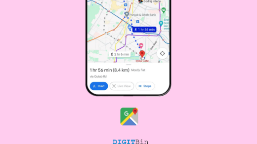
When you check for a location, Google Maps shows the estimated time it will take depending on the mode of transport you choose.
Car/bus/bike icons denote the route when you book a cab, grab a bus, and drive on your bike or car.
A walking person indicates the time estimated to reach the destination if you prefer walking.
Red Pin Icon
The destination point is marked with the red pin icon on the map. Zoom in on the map using your fingers to view the precise location of the destination.
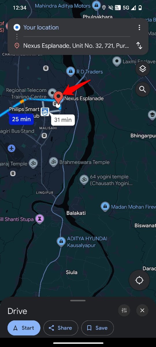
Route Highlighted in Blue Strip
The estimated route from the source to the destination point when traveled by bike, car, or bus is shown through the blue highlighted strip.
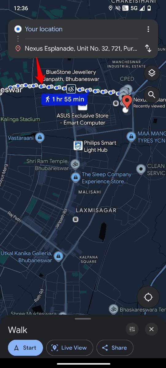
Route Highlighted in Dots
If you check the route to your destination when you prefer to walk from your current location, it will be shown on a dotted path.
Icons on an Active Journey Screen of Google Maps
After checking the route and directions, the journey will be marked as active on Google Maps once you press Start.
Several icons will appear on the right side of the screen.
Compass Icon
Press the compass icon to determine the direction. The red color points in the North direction and the grey points in the South.
![]()
![]()
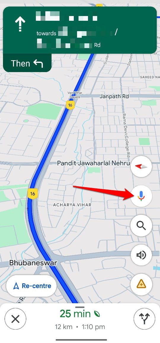
Colored Microphone
Press the colored microphone icon to summon the Google Assistant. While navigating towards your destination, use the virtual assistant to make a phone call, send a message, or play a song.
Search Icon
The search icon helps you look for places of interest along the route. You can search for restaurants, petrol pumps, cafes, public toilets, hotels etc.
![]()
![]()
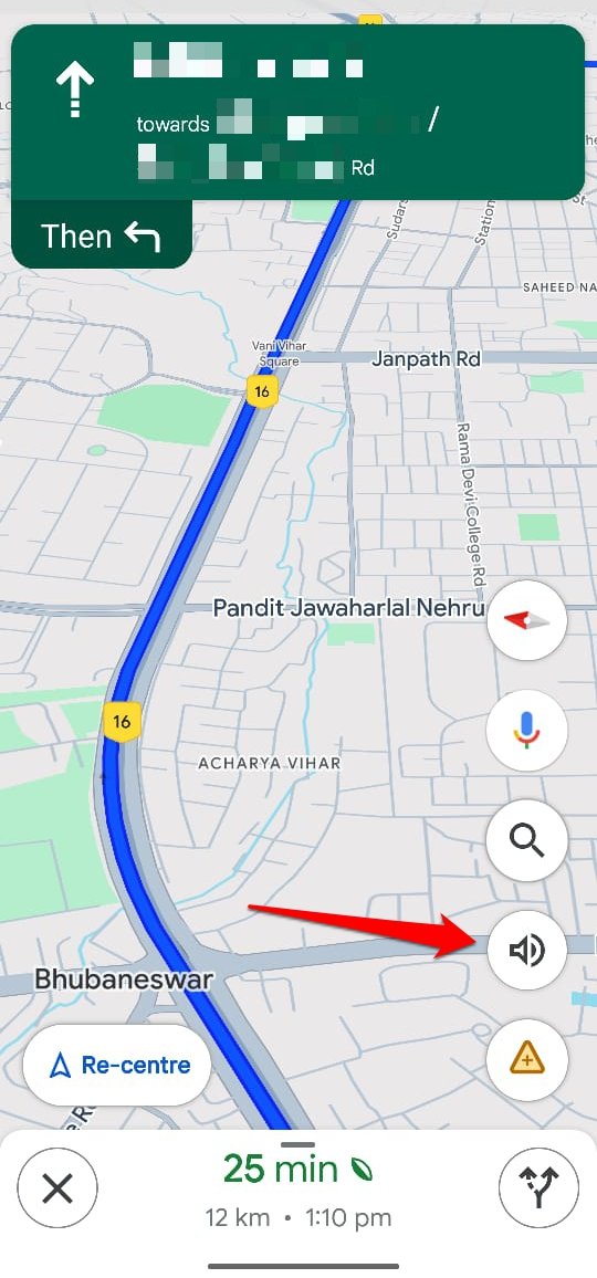
Speaker Icon
Press the Speaker Icon to mute or unmute the voice navigation on Google Maps.
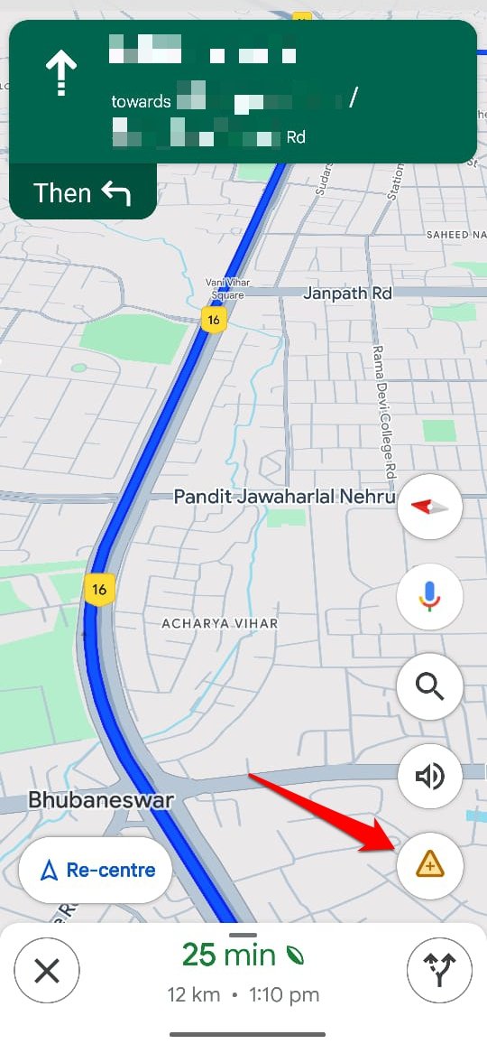
Add Report Icon
Use the report icon to report a crash, congestion, roadwork, lane closure, object on the road, etc. The reported data will help the other people navigating through the same route. They can know about possible obstructions on the route and take a different route to reach their destination.
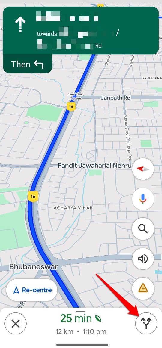
Forked Path Icon
Press this button to view the entire route from the source to the destination point.
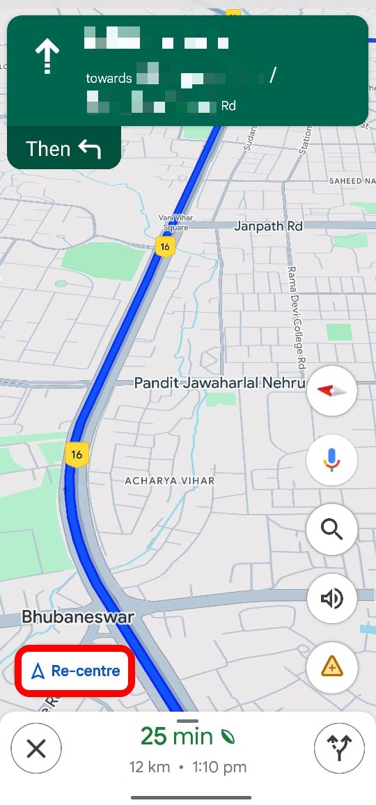
Re-Centre Button
Press the Re-centre button to resume the map navigation view from your current location. Use this button if the navigation halts for some reason.
Close the Navigation
Once you reach the destination, exit the Google Maps navigation by pressing the X button.
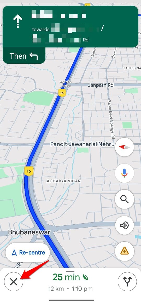
Green Leaf Symbol
This symbol appears right next to the estimated time for the completion of the ongoing journey.
![]()
![]()
It indicates that the route currently being taken can save up to 10 percent of petrol thus adding a little to the cause of saving the environment from pollution.
Road Condition Icons
To denote the condition of a specific route, some icons are widely used on Google Maps.
Dash within a Red Circle
This symbol denotes the closure of the road or a route through which vehicles cannot pass.
A Man with a Shovel Inside a Yellow Circle
This indicates ongoing construction work on a route. It may cause a delay in reaching the destination and the person may seek an alternative route.
![]()
![]()
A Car Inside a Red Circle
It denotes there is a possible vehicular accident on that route at a specific point.
Places of Interest Icons in Google Maps
Several icons On Google Maps denote a particular place of interest such as a cafe, office building, parking lot, restaurant, hotel, etc.
Here is a list of such icons you can find on Google Maps.
Mode of Transport
It is usually signified with Airplane(airport), bus, metro rail, train, subway, and ferry icons.
![]()
![]()
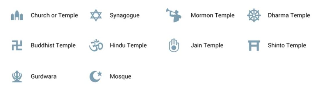
Places of Worship
Here are various symbols on Google Maps that denote churches, Hindu temples, Buddhist monasteries, synagogues, Gurdwara, Shinto temples, and Mosques.
Places of Leisure
Here is a collection of Google Maps icons that denote places of leisure such as Cafes, Theaters, Tourist places, museums, movie theatres, art galleries, shopping points, bars, and food courts.
![]()
![]()
Places for Public Access
It is the list of buildings or places that are accessible to the general public in a region. Check out these icons to understand them well on Google Maps.
![]()
![]()
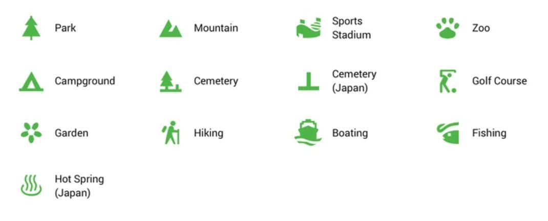
Places Denoting Outdoor Leisure or Service
Outdoor locations like forests, mountains, hiking trails, zoos, golf courses, camping grounds, stadiums for watching sports, and parks are denoted using these symbols.
Bottom Line
Let us wind up this guide. I’m sure now you are familiar with the various icons and symbols appearing on Google Maps. Navigating any location or finding a place of interest will be easier for you. If the Google Maps Live view is grayed out on your device, find a fix for that here.
If you've any thoughts on What Do Various Google Maps Icons and Symbols Mean, then feel free to drop in below comment box. Also, please subscribe to our DigitBin YouTube channel for videos tutorials. Cheers!